
With a focus on delivering high-quality drone services, we specialize in Aerial Imaging, Orthomosaic & Thermal Mapping, Stockpile Reporting, Solar Panel Inspections, and Search & Rescue (SAR) Assistance. We also provide professional drone instruction and are certified flight reviewers, committed to advancing skills and safety in unmanned aerial operations.
Here’s what we provide.
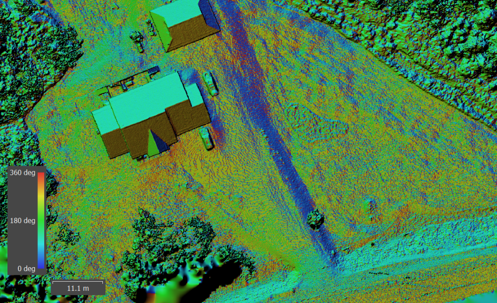
Orthomosaic Mapping
Q&S Drone Services leads the way in land maintenance and development through advanced orthomosaic mapping solutions. Leveraging state-of-the-art drone technology, our company creates high-resolution maps that accurately depict watersheds and land contours. These detailed visualizations enable landowners and developers to make well-informed decisions about land use and maintenance. By delivering precise spatial data, Q&S Drone Services supports sustainable development and efficient resource management across the region.
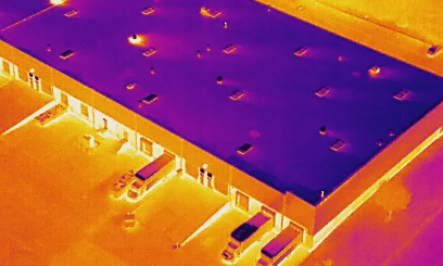
Thermal Inspections
Thermal drones are cutting-edge tools used across residential and commercial sectors for inspection purposes. Outfitted with advanced infrared cameras, these drones can detect heat loss in homes, making it easier to identify insulation problems or air leaks. In commercial environments, they help pinpoint faulty equipment by highlighting temperature anomalies that suggest malfunction. This technology improves the accuracy and efficiency of inspections, supporting proactive maintenance and promoting energy savings.

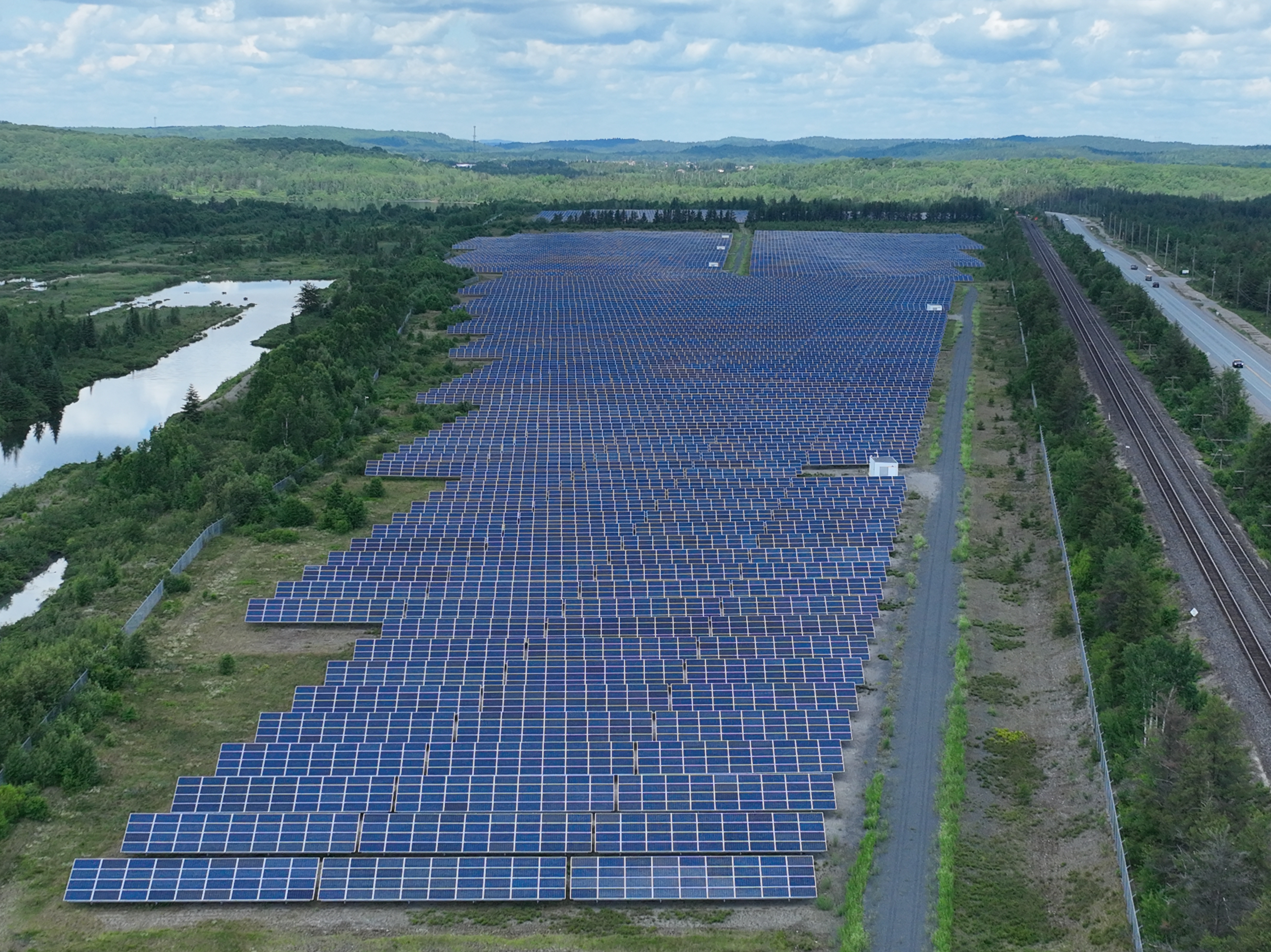
Solar Panel Inspections
Drones have revolutionized solar panel inspections by offering a faster, more efficient way to assess solar energy systems. With high-resolution cameras and thermal imaging capabilities, drones can quickly identify issues such as hotspots, cracks, or debris—removing the need for time-consuming manual inspections. This advanced method reduces labor costs and minimizes system downtime, ensuring optimal energy production. By delivering accurate and thorough evaluations, drone technology plays a vital role in maximizing the performance and longevity of solar installations.
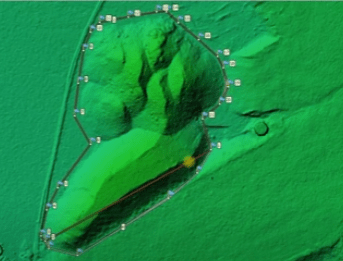
Stock Pile Reproting
Drones have transformed the way gravel pits are mapped and stockpile reports are generated. By capturing high-resolution aerial imagery, they enable accurate and efficient data collection for precise volume measurements and stockpile analysis. This technology enhances safety by minimizing the need for manual surveys in potentially hazardous areas, while also streamlining reporting for regulatory compliance. Incorporating drones into pit management operations results in greater efficiency, improved accuracy, and more informed decision-making.
FAQs
Ready for your mapping needs to takeoff?
Contact us below to schedule your consultation and find out how we can help you.
Contact
Trout Creek, Ontario
(613) 281-8748
info@qsdroneservices.ca
